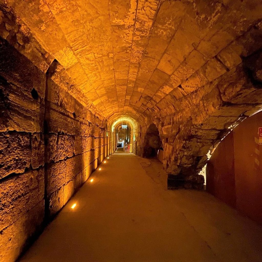
The Western Wall Tunnel is a tunnel exposing the Western Wall from where the traditional, open-air prayer site ends and up to the Wall’s northern end. Most of the tunnel is in continuation of the open-air Western Wall and is located under buildings of the Muslim Quarter of the Old City of Jerusalem. Since the majority of its original length of 488 meters (1,601 ft) is located today underground. The tunnel allows access to the remainder of the Wall dated to the Herodian Period.
The History of the Western Wall Tunnel
In 19 BCE, King Herod undertook a project to double the area of the Temple Mount in Jerusalem by incorporating part of the hill on the Northwest. In order to do so, four retaining walls were constructed, and the Temple Mount was expanded on top of them. These retaining walls remained standing, along with the platform itself, after the Temple was destroyed by the Romans in 70 CE.
Since then much of the area next to the walls became covered and built upon. Part of the Western Wall remained exposed after the destruction of the Temple. Since it was the closest area to the Temple’s Holy of Holies that remained accessible, it became a place of Jewish prayer for millennia. Here is a link to their website for more info!
Excavations in the Western Wall Tunnel
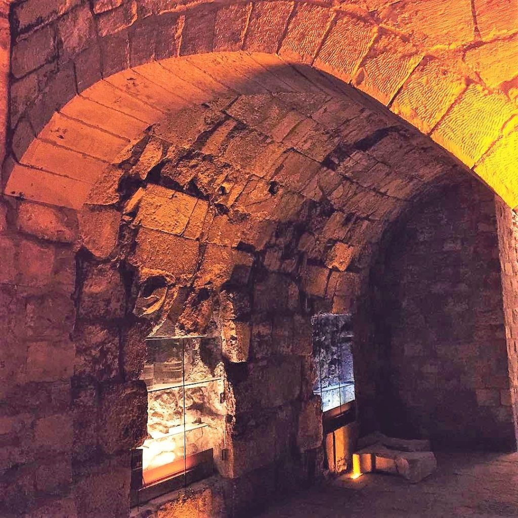
British researchers started excavating the Western Wall in the mid 19th century. Charles Wilson began the excavations in 1864 and was followed by Charles Warren in 1867–70. Wilson discovered an arch now named for him, “Wilson’s Arch” and is above present-day ground level. It is believed that the arch supported a bridge that connected the Temple Mount to the city during the Second Temple Period. Warren dug shafts through Wilson’s Arch which are still visible today.
After the Six-Day War, the State of Israel began excavations aimed at exposing the continuation of the Western Wall. The excavations lasted almost twenty years and revealed many previously unknown facts about the history and geography of the Temple Mount. The excavations were difficult to conduct, as the tunnels ran below residential neighborhoods constructed on top of ancient structures from the Second Temple Period.
Points of Intrest in the Western Wall Tunnel
The tunnel exposes 300 m of the wall’s total 445 m, revealing the construction methods and the various activities in the vicinity of the Temple Mount. The excavations included many archaeological finds along the way, including discoveries from the Herodian period (streets, monumental masonry); sections of a reconstruction of the Western Wall dating to the Umayyad period, and various structures dating to the Ayyubid, Mamluke, and Hasmonean periods constructed to support buildings in the vicinity of the Temple Mount.
Western Wall Tunnel: Warren’s Gate
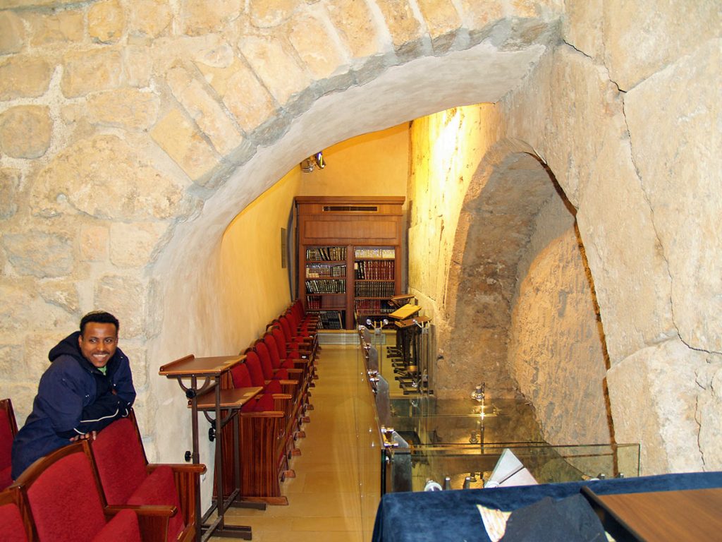
“Warren’s Gate” lies about 150 feet (46 m) into the tunnel. This sealed-off entrance was for hundreds of years a small synagogue called “The Cave”, where the early Muslims allowed the Jews to pray in close proximity to the ruins of the Temple. Rabbi Yehuda Getz built a synagogue just outside the gate since today it is the closest point a Jew can pray near to the Holy of Holies, assuming it was located at the traditional site under the Dome of the Rock.
Western Wall Tunnel: Hasmonean Channel
Beyond the northern end of the Western Wall, remains were found of a water channel that originally supplied water to the Temple Mount. The exact source of the channel is unknown, though it passes through an underground pool known as the “Struthion Pool”. The water channel was dated to the Hasmonean period and was accordingly dubbed the “Hasmonean Channel”.
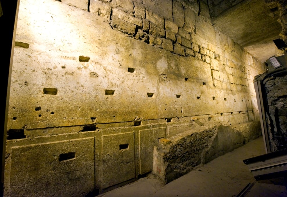
Another point of interest is The biggest stone in the Western Wall, often called the Western Stone, is also revealed within the tunnel, and ranks as one of the heaviest objects ever lifted by human beings without powered machinery. The stone has a length of 13.6 meters (45 ft), the height of 3 meters (9.8 ft), and an estimated width of between 3.5 meters (11 ft) and 4.5 meters (15 ft); estimates place its weight at 570 short tons (520 metric tons)!


