Tel Gezer is an archaeological site in the foothills of the Judaean Mountains, roughly midway between Jerusalem and Tel Aviv. It is now an Israeli national park. In the Hebrew Bible, Gezer is associated with Joshua and Solomon. Moreover, Tel Gezer became a major fortified Canaanite city-state in the first half of the 2nd millennium BCE. It was later destroyed by fire and rebuilt.
In fact, the Amarna Letters mention kings of Gezer swearing loyalty to the Egyptian pharaoh. Its importance was due in part to the strategic position it held at the crossroads of the ancient coastal trade route linking Egypt with Syria, Anatolia, and Mesopotamia, and the road to Jerusalem and Jericho, both important trade routes. The mound is one of the most important mounds in the Land of Israel, along with the mounds of Hatzor, Megiddo, and Beer Sheva.
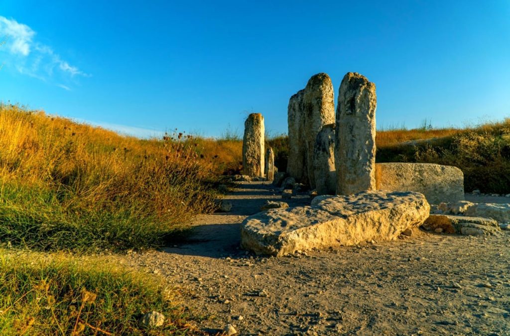
Tel Gezer in the Bronze Age
The Canaanite city was destroyed in a fire, presumably in the wake of a campaign by the Egyptian pharaoh Thutmose III (ruled 1479–1425 BCE). The oldest known historical reference to the city is to be found on an inscription of conquered sites at Thutmose’s temple at Karnak. A destruction layer from this event was found in all excavated areas of the tell. In July 2017, archaeologists discovered skeletal remains of a family of three, one of the adults and a child wearing earrings, believed to have been killed during an Egyptian invasion in the 13th-century BCE. A 13th century BCE amulet, various scarabs, and cylinder seals were also found on the site. The amulet bears the cartouches —or official royal monikers— of the Egyptian Pharaohs Thutmose III and Ramses II
Tel Gezer and the Amarna Letters
The Amarna letters, dating from the 14th century BCE, include ten letters from the kings of Gezer swearing loyalty to the Egyptian pharaoh. The city-state of Gezer (named Gazru in Babylonian) was ruled by four leaders during the 20-year period covered by the Amarna letters. Discoveries of several pottery vessels, a cache of cylinder seals, and a large scarab with the cartouche of Egyptian pharaoh Amenhotep III attest to the existence of a city at Gezer’s location in the 14th century BCE – one that was apparently destroyed in the next century – and suggest that the city was inhabited by Canaanites with strong ties to Egypt.
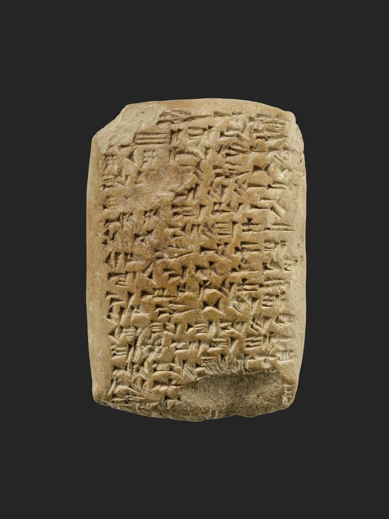
AMARNA LETTER, CA. 1353–1336 B.C.E
In the Late Bronze Age (second half of the 2nd millennium BCE) a new city wall, four meters thick, was erected outside the earlier one. It is a very rare example of Late Bronze Age fortifications in the country, witness for the elevated political status of Gezer in southern Canaan during Egyptian rule. In the 14th century BCE, a palace was constructed on the high western part of the tell, the city’s acropolis. Archaeologists also discovered remains of what might have been the Egyptian governor’s residence from the same period in the northern part of the tell. Toward the end of the Bronze Age, the city declined and its population diminished.
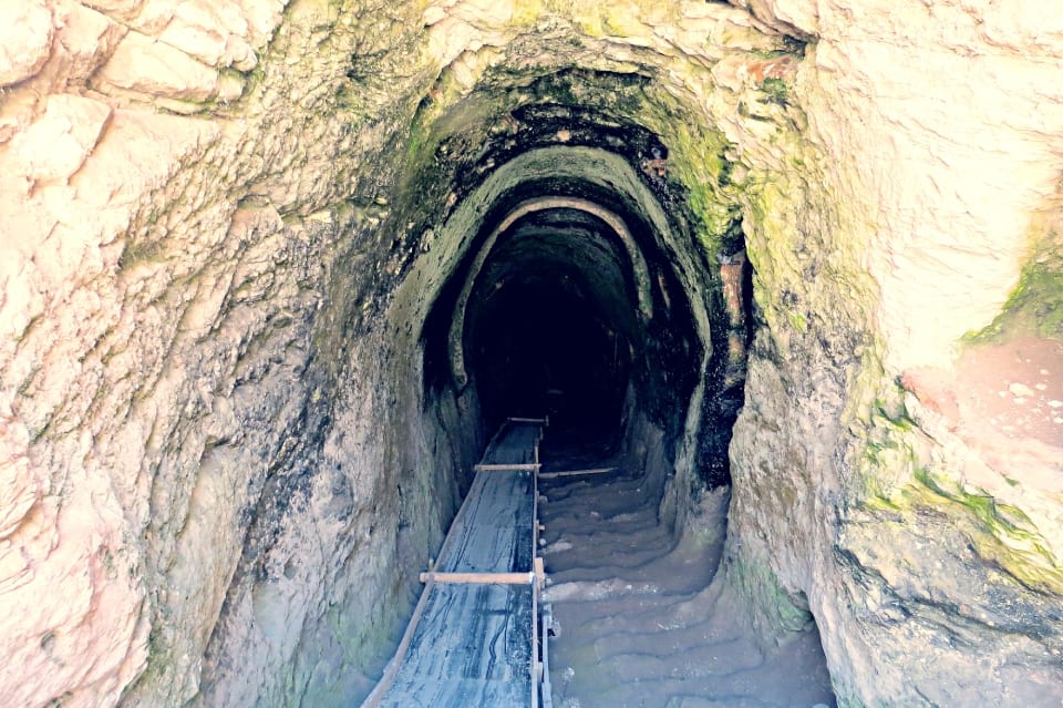
CANAANITE WATER SYSTEM
Canaanite Water System
A large Canaanite (Bronze Age) water system comprising a tunnel going down to a spring, similar to those found in Jerusalem, Hazor, and Megiddo, was first excavated by Macalister and was re-excavated as part of[citation needed] the 2006-17 campaigns of the Tel Gezer Excavation and Publication Project.
THE EGYPTIAN GOVERNOR’S RESIDENCE
In the 12th-11th centuries BCE, a large building with many rooms and courtyards was situated on the acropolis. Grinding stones and grains of wheat found among the sherds indicate that it was a granary. Local and Philistine vessels attest to a mixed Canaanite/Philistine population.
Archeological Findings
Archaeological excavation at Gezer has been going on since the early 1900s, and it has become one of the most excavated sites in Israel. The site was identified with ancient Gezer by Charles Simon Clermont-Ganneau in 1871. R. A. Stewart Macalister excavated the site between 1902 and 1909 on behalf of the Palestine Exploration Fund. Macalister recovered several artifacts and discovered several constructions and defenses.
He also established Gezer’s habitation strata, though due to poor stratigraphical methods, these were later found to be mostly incorrect (as well as many of his theories). Other notable archaeological expeditions to the site were made by Alan Rowe (1934), G.E. Wright, William Dever and Joe Seger between 1964 and 1974.
The first season of the Gezer excavations concluded successfully and revealed some interesting details. Among other things is a discovery of A thick destruction layer that may be dated to the destruction at the hands of the Egyptians, which some associate with the biblical episode from 1 Kings 9:16.
Tel Gezer calendar
One of the best-known finds is the Tel Gezer calendar. This is a plaque containing a text appearing to be either a schoolboy’s memory exercises, or something designated for the collection of taxes from farmers. Another possibility is that the text was a popular folk song, or child’s song, listing the months of the year according to the agricultural seasons. It has proved to be of value by informing modern researchers of ancient Middle Eastern script and language and the agricultural seasons.

GEZER CALENDAR
Historical and Bilical Records of Tel Gezer
Gezer is mentioned in the Victory Stele of Merneptah, dating from the end of the 13th century BCE. Moreover, the biblical story of the Israelite conquest of Canaan under their leader Joshua mentions a certain “king of Gezer” (Joshua 10:33) who had gone to help his countrymen in Lachish, where he met his death. Also, Gezer is listed in the Book of Joshua as a Levitical city, one of ten allotted to the Levite children of Kehoth – the Kohathites (Joshua, ch. 21).
The Egyptian Sack of Gezer
According to the Hebrew Bible, the only source for both the existence of Solomon and this particular event, the Sack of Gezer took place at the beginning of the 10th century BCE, when the city was conquered and burned by an unnamed Egyptian pharaoh, identified by some with Siamun, during his military campaign in Philistia. This anonymous Egyptian pharaoh then gave it to King Solomon as the dowry of his daughter. Solomon then rebuilt Gezer and fortified it.
15 Here is the account of the forced labor King Solomon conscripted to build the Lord’s temple, his own palace, the terraces, the wall of Jerusalem, and Hazor, Megiddo, and Gezer. 16 (Pharaoh king of Egypt had attacked and captured Gezer. He had set it on fire. He killed its Canaanite inhabitants and then gave it as a wedding gift to his daughter, Solomon’s wife. 17 And Solomon rebuilt Gezer.)
1 Kings 9: 15-16
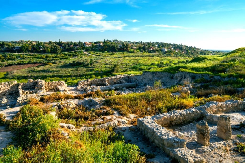
In 1957 Yigael Yadin identified a wall and six-chambered gateway very similar in construction to remains excavated at Megiddo and Hazor as Solomonic; they have since been reinterpreted by some as dating from several centuries later.
THE ‘SOLOMONIC GATE’ AT GEZER
The Boundary Stones
Thirteen boundary stones have been identified near the tell, distanced between less than 200 meters to almost 2 km from it, probably dating from the Late Hellenistic period (late second – first century BCE), the most recent having been found by archaeologists in 2012.
Only a few “lost” biblical cities have been positively identified through inscriptions discovered by means of archaeological work (surveys or digs). Gezer is the first among them thanks to Clermont-Ganneau’s discovery of three such inscribed stones in 1874 and of a fourth in 1881.
TEL GEZER BOUNDARY STONES
Ten of the thirteen inscriptions are bilingual, including the first three ones, containing two distinct parts, one in Greek and one either Hebrew or Aramaic and written in what is known as square Hebrew characters. Clermont-Ganneau’s reading of the Hebrew/Aramaic part as “the boundary of Gezer” was later confirmed. The inscriptions’ Greek part contains personal names, either (H)alkios, Alexas, or Archelaos, for instance, Clermont-Ganneau’s four stones were all bearing the inscription “of Alkios”.
Sometimes the two parts are upside-down, or “tête-bêche”, in relation to each other, on the last discovered one the lines being separated by a line and the Hebrew/Aramaic inscription “Tehum Gezer” (“the boundary of Gezer”) facing the tell. With the discovery of the last nine inscriptions, it became evident that their distribution does not support Clermont-Ganneau’s initial interpretation, marking Gezer’s Sabbath limit, but rather that they probably mark the boundaries between private, or between city land and these estates.
Herodian or Hasmoneans?
Analysis of the lettering has led to the conclusion that they were all contemporaneous, with opinions based on paleography and history slightly diverging in regard to their date – either Hasmonean or Herodian. The earlier date and the Hebrew script can be connected to what we know from the First Book of Maccabees about Simon replacing the gentile inhabitants with Jewish ones (1 Macc. 13:47-48) The latter date can be supported by a scenario in which Herod, after acquiring the lands of the vanquished Hasmoneans, gave them to (H)alkios, Archelaos and Alexas, all three names mentioned by Josephus for members of a powerful land-owning family from Herod’s court.


