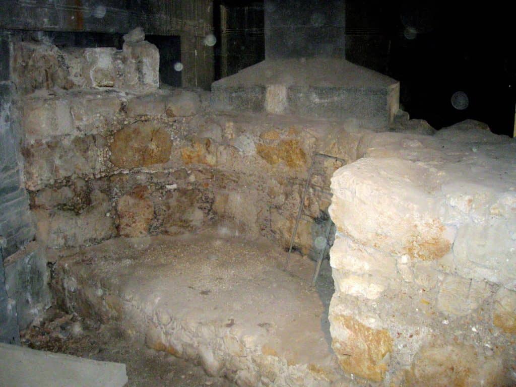
The New Church of the Theotokos (The Nea Church) was a Byzantine church erected in Jerusalem by the Byzantine Emperor Justinian I. The church was completed in 543 but was severely damaged or destroyed during the Persian conquest of the city in 614. It was further used as a source of building material by the Umayyads a few decades later.
Credit: Deror avi, CC BY-SA 3.0, via Wikimedia Commons
New Church of the Theotokos: Primary Sources
Two contemporary accounts survive that describe the building of the Nea, but neither author has much to say about the shape and organization of the church complex. Cyril of Scythopolis, a Christian monk who lived in 525–558, records that the church was begun by the Patriarch Elias but left unfinished until Justinian allocated funds for its completion at the behest of St. Sabas in 531.
A more detailed account of the church and its construction comes from Procopius, the principal historian of the sixth century and the primary source of information for the rule of Emperor Justinian. In his De Aedificiis, he writes, “in Jerusalem he [Justinian] dedicated to the Mother of God a shrine with which no other can be compared.”
The Nea was situated on Mount Zion, the highest hill in the city, near the Church of the Holy Apostles (built-in 347) and the Basilica of Hagia Sion (built-in 390). Due to the rugged topography, the architect Theodoros first had to extend the southeastern part of the hill and support the church with huge substructures. This account by Procopius corresponds with the excavations of Archaeologist Yoram Tsafrir, as well as a tablet uncovered on the vaulted subterranean cistern that securely dates the building to 543.
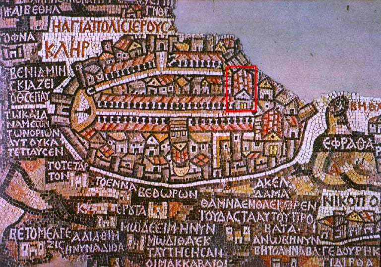
The Nea and the Madaba Map
In addition to the contemporary literary accounts and archaeological evidence, the Madaba Map preserves a sixth-century perception of the topography, cities, and monuments of the Mediterranean. Furthermore, the mosaic was discovered on the floor of the Church of St. George in Madaba, Jordan, and has been dated from 560–565, less than twenty years after the inauguration of the Nea in 543, and it is the oldest surviving cartographic representation of the Holy Land.
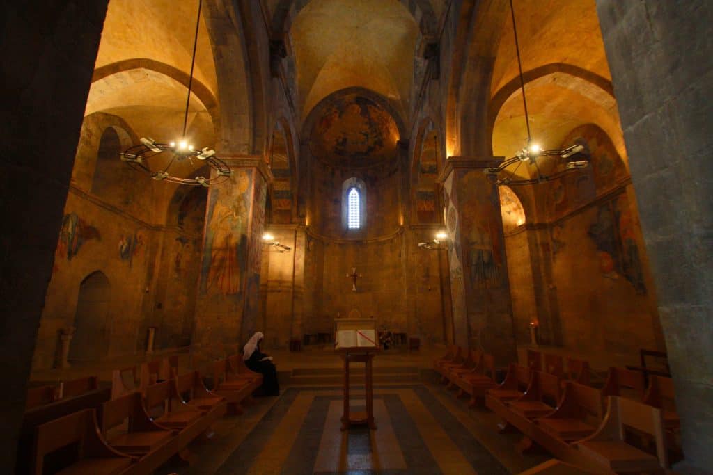
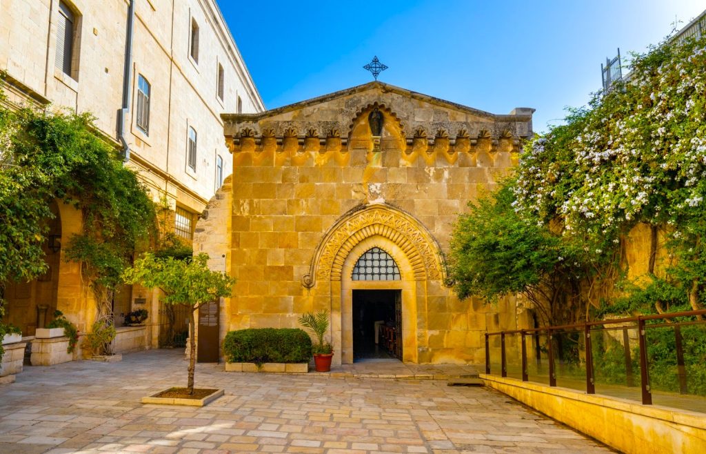
St. Mary of the Resurrection In Abu Gosh
The map depicts the Mediterranean world from Lebanon in the North to the Nile Delta in the South, and from the Mediterranean Sea in the west to the Eastern Desert. The city of Jerusalem is given prominence by its size and the mosaicists’ devotion to the detail of its monuments. No city represented in the map is larger. The central location of Jerusalem in the mosaic further supports Jerusalem’s importance in the minds of the map’s creators.
A closer look at Jerusalem reveals a pictorial representation of the city and its surrounding landscape. It is depicted from a diagonal bird’s eye perspective with no topographical impediments. The city’s two cardos extend south from the Damascus Gate, with the main cardo horizontally bisecting the walled city. The street is opened so that each colonnaded side is equally visible.
The Prominence of the New Church of the Theotokos is Declining
The Church of the Holy Sepulchre is the largest building on the map; suggesting its importance in the city’s architectural hierarchy. It is situated perpendicular to the main cardo on its western side. All components of the church – the rotunda, the basilica, the atrium, the eastern façade, and the exterior stairs – are visible. Although the Holy Sepulchre is geographically located to the north of the Tetrapylon, the main road running perpendicular to the cardo from David’s Gate, on the map, it is situated where the decumanus should be. Not only does its size emphasize the church’s importance, but its central location on the cardo also furthers its reputation as the most sacred and popular pilgrimage site in the Holy City.
Monastery of St. John in the Wilderness
The Nea is the third most prominent monument in the city after the Holy Sepulchre and Hagia Sion, even though in actuality it was the largest church in Jerusalem. The hieratic scale of monuments leads one to question how the Nea functioned in relation to the other monuments within the topography of the sixth century.
The selective details of Jerusalem’s monuments reveal the Madaba Map to be concerned with providing the viewer with a topographical hierarchy of Old and New Testament places. When viewed as a rendition of Jerusalem that reflects the sixth-century habitus of Jerusalem, the map reveals a conception of the Christian sacred spaces and their interconnectedness.
New Church of the Theotokos and the Topography of Jerusalem
The shift in Christian topography to the western part of the city is clearly visible. For example, the Temple Mount, the central religious monument to Jewish identity, is relegated to the city’s eastern periphery, eclipsed by the towering Christian monuments that occupy the center of the city. Archaeologist Yoram Tsafrir has identified this area as an open esplanade, marking the place of the Temple Mount.
Church of the Flagellation
The map guides pilgrims and viewers to the holy spaces, supporting Justinian’s campaign to integrate the Nea as a sacred site that matched the holiness of the Holy Sepulchre and Hagia Sion. Justinian extended the cardo south to the Nea and the newly constructed Zion Gate to provide access to the Nea. This decision undoubtedly had political motivations, for it situated the Nea on the main route for pilgrims traveling between the Church of the Holy Sepulchre and the Church of the Holy Apostles.
Processions, stational liturgies, and individual worshipers passed between the Holy Sepulchre and Hagia Sion, thus including Justinian’s church. However, the Nea still failed to gain a place in the Christian collective memory as a site that was as holy as the other two main churches. According to Antoninus of Piacenza, worshipers went straight from the Holy Sepulchre to Hagia Sion, only to double back to the Nea. Furthermore, by the 630s, Patriarch Sophronius did not mention the Nea in his review of pilgrimage sites in Jerusalem.
The Reasons for the Construction of the New Church of the Theotokos
Urban-Physical Planning
Scholars list four reasons for establishing the church: In the days of Justinian, Jerusalem was one of the largest and richest cities in the empire. Moreover, in the time of Justinian, Jerusalem peaked in its development as a sacred city. Due to this and the relative peace during this period, pilgrims worldwide flocked to it.
The city had to contain a considerable increase in the number of pilgrims coming to it. Cyril of Scythopolis says that St. Sabas (Mar Saba) was sent as ambassador on behalf of the heads of Jerusalem to Constantinople (at the age of 94) to ask the emperor to renew the construction of the Theotokos Church (Mother of God), which also includes a hostel and hospital for foreign pilgrims.
Justinian extended the city as far south as possible to create a space between the Church of the Holy Sepulcher and Mount Zion. It is both a sacred space (processions and the like) and a space for civic life, especially for the benefit of the pilgrims and the services provided to them in the city.
Theological Reason
During this period, the cult of Miriam expanded in the church. Particularly sharp is the debate over whether Mary is the mother of God or the mother of flesh and blood. Justinian emphasizes that this is the Church of the Theotokos (literally: Mother of God). In those days, the legend was already prevalent that if God died on Mount Zion, then Mount Zion was the right place to build a church in her name.
Glorifying the Name of Justinian:
By building a mighty church in a “new” area, where there was previously no conspicuous presence of another monument, Justinian imprints his name for generations. Thus Justinian takes care to perpetuate his name in many places in his empire – through massive construction and development of previously desolate places.
Christian Version of the temple:
There seems to be in the church, and Procopius’ description hints at a destroyed Jewish 2nd Temple. Justinian built a huge monument by artificially expanding the mountain (like Herod on the Temple Mount), and used cedars in its construction (like King Solomon). The topographic location of the “Nea” is higher than the Temple Mount, and the pillars of the destroyed 2nd Jewish Temple may have been used.


