This sixth section of the Israel National Trail: Kinneret begins with a climb to the top of Mount Arbel with all its history. Then, it continues to pass through Tiberias, one of the holy cities for Judaism. Finally ending in a small spring and a Jewish colony; among the first to be founded in the Sea of Galilee area. So for those looking for epic views and combine with some Biblical key sites; this section of the trail is for you! Our days begin early if you’re doing the Israel National Trail. I mean be prepared for a long 12-hour hike if you want to do the entire section. We will start from the outskirts of Modern Migdal that is very close to Ancient Migdal. Yes, the same place where Mary Magdalene came from!
Israel National Trail, Kinneret: The Magdala stone
The Magdala Stone is a carved stone relief that shows a seven-branched menorah flanked by a pair of two-handled jugs and a pair of columns. In fact, this is the first time that a menorah decoration has been discovered from the days when the Second Temple was still standing. Furthermore, it is the first menorah to be discovered in a Jewish context; and that dates to the Second Temple period/beginning of the Early Roman period. Perhaps it was done by an artist who saw the seven-branched menorah with his own eyes in the Temple in Jerusalem.
We will see another famous trail that people tend to hike in the Holy Land. In other words, I mean to the famous Jesus Trail that passes right next to us! The Jesus Trail is a 65 km hiking and pilgrimage route in the Galilee region of Israel that traces the route Jesus may have walked, connecting many sites from his life and ministry. The main part of the trail begins in Nazareth and passes through Sepphoris, Cana; the Horns of Hattin, Mount Arbel Cliffs, the Sea of Galilee, Capernaum, Tabgha, and the Mount of Beatitudes.

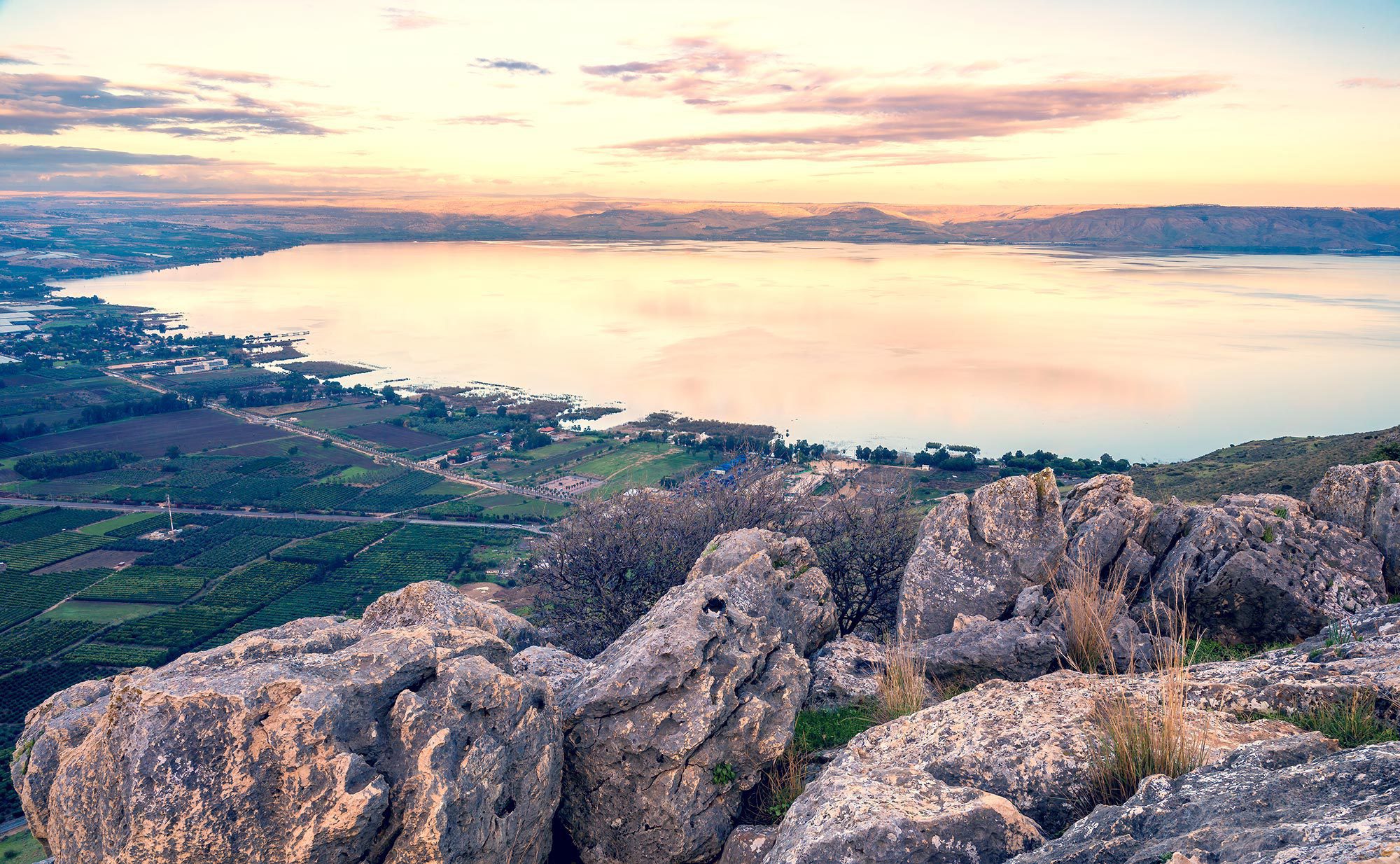
THE SUNRISE FROM MOUNT ARBEL OVERLOOKING THE SEA OF GALILEE
Israel National Trail, Kinneret: The Battle of Hittin
So our next stop would be Kfar (Village in Hebrew) Hittin. The Ancient village of Hittin was located on the northern slopes of the double hill known as “Horns of Hattin.” It was strategically and commercially significant due to its location overlooking the Plain of Hittin. In fact, this plan opens onto the coastal lowlands of Lake Tiberias to the east, and to the west is linked by mountain passes leading towards the plains of lower Galilee. These plains, with their east-west passages, served as routes for commercial caravans and military invasions.
In fact, one of these military invasions was the Battle of Hattin. This battle was the famous battle in which the Muslim army led by Saladin defeated the Crusader army in 1187; leading to the siege and defeat of the Crusaders who controlled Jerusalem. The modern Kfar Hittin is one of the first tower and stockade settlements. Near there is the famous site of Nabi Shu’ayb – the supposed burial site of Jethro (Jethro), a site revered by the Druze.
Israel National Trail, Kinneret: Moshavat Kinneret
So we will end this section of the Israel National Trail at one of the first Jewish Settlements that was established next to the Sea of Galilee. Moshavat Kinneret was part of the settlement project of Baron Edmond de Rothschild and the Jewish Colonisation Association, while the Kinneret Farm was the initiative of the Palestine Bureau of the Zionist Organisation. The village and the farm shared infrastructure (health; security; cultural life); but served different purposes. The village was established as a frame for families willing to settle the land and start their own business.

